The ultimate pre-flight companion for drone pilots.
Android port of a successful iOS drone weather app — real-time wind, celestial data, no-fly zones, and a map-first interface for pilots worldwide.
The brief
Drone pilots need very specific environmental data before flying — precise wind conditions, visibility levels, exact sun position, and airspace risk. Standard weather apps provide none of this drone-specific context.
The challenge
Porting a feature-rich, map-first iOS app to Android with minimal client input — using the published iOS version as the sole reference and matching its experience on a completely different native stack.
Our solution
A serverless Android app pulling real-time drone weather and planetary data directly from the Dark Sky API, with a Mapbox map interface, no-fly zone overlays, and push alerts — no backend required.
Six things that make Drone Buddy work.
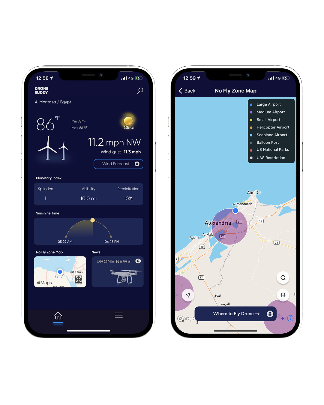
Drone weather data
Real-time wind speed, direction, visibility, and precipitation data tailored for flight safety.
Celestial planning
Precision sun/moon tracking, sunrise/sunset times, and golden hour windows for photography timing.
No-fly zone map
Global airspace safety layer covering international airports, TFRs, and national park boundaries.
Mapbox map interface
High-performance interactive map with instant GPS detection and global location search for scouting conditions anywhere.
"Where to Fly" community
Interactive pilot-submitted map of recommended takeoff locations around the world.
Push alerts
Firebase FCM instant notifications for critical updates and flight condition changes.
What it looks like.


The tools we picked, and why we kept them simple.
Boring tech where boring is right, sharp tech where it counts.
What changed after launch.
They are very skillful, understand the needs of their clients, and deliver quality results.